Shamrock Loop Map

For a fully interactive map with links to videos and Facebook Posts use this link:

User Guide

Desktop

 Not needed

Android

This assumes that the link has opened in the Google Maps App not a browser!
The map is much quicker, more responsive in the app!

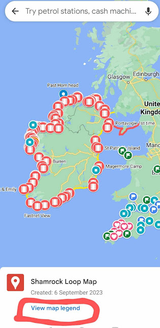
To close map select View map legend


Then select close

Note: There are three types of layer you can select as few or as many as you like with the tick boxes

To open map again: Select Saved


Scroll down to the very bottom and select Maps


Comments

Popular posts from this blog

I'm Off

 Kayak Demelza is underway! Follow my live track, 10-minute intervals Live Tracking Follow me on Instagram or Facebook Social Media There is even a feed for none Facebook Users Daily Updates

Dances with Seals

This was just great. Click for video

Severn Estuary - Tides, Islands, Lighthouses and Bridges

Check out the video Notes on doing 100km. I am Slow but Steady, my cruising speed is kph, but when you account for snack breaks, looking at maps, posting on social media and stopping and sighing that becomes 6. If I did 100k at that speed, you are looking at the best part of 17 hours, which is not a pleasant thought. Tidal assistance is required to make the task more palatable, which dictates a maximum of 12 hours for a there and back, +/-2 hours. Where better to get tidal assistance than the mighty Severn Estuary. To complicate matters I wanted to go under the two bridges and paddle around the islands Flatholm and Steepholm, which meant doing the 4km crossing between the two at slack tide. Everything lined up perfectly, high tide at the Severn bridge was at 9am a very civilised start time, the distance to Steepholm was a convenient 45km and the weather was sublime. I could have delayed my start by an hour to get better tidal assistance but the need to have some contingency won out. I ...